Why Multi-Sensor UAVs Are the Future of Professional Drone Operations
Traditional drone systems often limit operators to one sensor per mission. For example, a mapping drone may carry an RGB camera for photogrammetry, but switching to thermal inspection or multispectral imaging requires landing, replacing equipment, recalibrating, and performing another flight.
This approach creates several problems:
• Increased operational costs
• Longer mission times
• More battery consumption
• Greater risk during repeated takeoffs and landings
• Fragmented datasets collected at different times
A multi-sensor UAV solves these problems by allowing operators to collect all necessary data in a single flight.
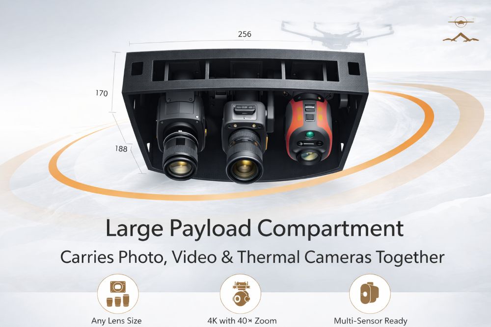
This is exactly where the Geohawk UAV platform excels. Its large survey drone payload compartment makes it possible to mount several sensors simultaneously while maintaining stability and performance.
Large Payload Compartment: The Key Advantage of Geohawk
One of the defining features of the Geohawk platform is its exceptionally spacious payload compartment, engineered specifically for professional aerial equipment.
Many UAV systems prioritize compact design at the cost of payload flexibility. Geohawk takes the opposite approach: it provides a large internal volume capable of accommodating a wide range of cameras and sensors without forcing operators to compromise.
This payload compartment allows the drone to carry multiple systems such as: • High-resolution photographic cameras for photogrammetry
• 4K video cameras with up to 40× optical zoom
• Thermal imaging cameras for industrial inspections
• Multispectral sensors for agriculture and environmental monitoring
• Oblique cameras for advanced 3D modeling
This flexibility transforms Geohawk into a true multi-sensor survey drone, capable of performing complex missions that would normally require several separate UAV flights.
Any Lens Size for Professional Photogrammetry Cameras
Professional aerial surveyors often require specific camera lenses to achieve the desired ground sampling distance (GSD) and image clarity.
However, many drones limit lens size because their payload compartments are too small. This restriction can prevent operators from using high-quality photogrammetry equipment.
Geohawk removes this limitation.
Its payload compartment supports photographic cameras with virtually any lens size, allowing professionals to install equipment optimized for:
• High-precision aerial mapping
• Topographic surveys
• Construction progress documentation
• Urban planning projects
• Large-scale infrastructure surveys
By allowing greater flexibility in camera selection, Geohawk ensures that operators can achieve the highest possible image quality for professional mapping applications.
4K Video with 40× Optical Zoom for Industrial Inspections Industrial inspection is one of the fastest-growing sectors in the UAV industry.
From powerline monitoring to oil refinery inspections, drones have become essential tools for safely collecting visual data in hard-to-reach locations.
Geohawk supports 4K video cameras with up to 40× optical zoom, giving operators the ability to capture extremely detailed footage while maintaining safe distances from critical infrastructure.
This capability is particularly valuable for industrial inspection drones used in:
• Electrical transmission line inspection
• Wind turbine blade monitoring
• Oil and gas facility inspection
• Bridge and highway infrastructure evaluation
• Telecommunications tower inspections
With powerful optical zoom and high-resolution video capture, operators can identify small structural defects without physically approaching the structure, improving both safety and efficiency.
Multi-Sensor Ready: RGB, Multispectral, Thermal, and Oblique Cameras
One of the most important aspects of the Geohawk platform is its multi-sensor ready architecture.
The drone is designed to support a wide variety of sensor systems simultaneously, including:
RGB Cameras
Standard RGB cameras remain the foundation of aerial photogrammetry and mapping. Geohawk supports high-resolution RGB cameras capable of generating accurate orthomosaics and 3D terrain models.
Applications include:
• Land surveying
• Urban mapping
• Construction monitoring
• Infrastructure planning
Multispectral Sensors
Multispectral cameras capture data beyond the visible spectrum and are widely used in precision agriculture and environmental monitoring.
Mounted on Geohawk, multispectral sensors can analyze vegetation health, identify irrigation issues, and monitor crop conditions across large agricultural areas.
Thermal Cameras
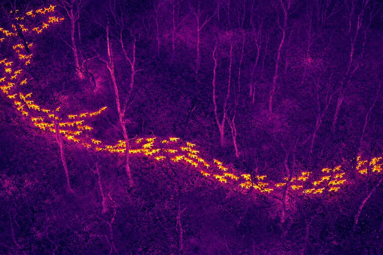
Thermal imaging is essential for many industrial applications. By detecting heat signatures, thermal sensors allow operators to identify issues that are invisible to standard cameras.
Thermal cameras mounted on Geohawk are commonly used for:
• Solar panel inspection • Electrical fault detection
• Building energy efficiency analysis
• Search and rescue operations
Oblique Cameras
Oblique cameras capture images at angled perspectives rather than directly downward. These images are critical for creating high-quality 3D city models and digital twins.
Geohawk’s large payload compartment makes it possible to install oblique camera systems that capture multiple perspectives simultaneously, enabling accurate reconstruction of complex urban environments.
A Powerful Survey Drone Payload for Complex Missions
The large payload capacity of Geohawk enables professionals to combine multiple sensor technologies within a single mission profile.
For example, during a surveying mission the drone could simultaneously capture:
• RGB images for photogrammetry
• Thermal imagery for infrastructure diagnostics
• High-zoom video for inspection documentation
Instead of running three separate flights, operators can complete the entire project in one efficient operation.
This capability significantly improves:
• Operational efficiency
• Data synchronization
• Mission planning
• Overall project profitability
Competitive Advantage Over Other UAV Platforms
Many UAV systems currently available in the market offer impressive flight performance but limit sensor integration due to small payload bays.
Geohawk stands apart by prioritizing payload versatility, which provides several advantages over conventional drones:
1. Multi-Sensor Integration
Geohawk allows simultaneous installation of several sensor types, reducing mission complexity.
2. Flexible Camera Compatibility
The platform supports cameras with large professional lenses, which many drones cannot accommodate.
3. Industrial Inspection Capability With 4K video and high optical zoom, Geohawk is well suited for industrial inspection drone applications.
4. Efficient Data Collection
Multi-sensor capability allows operators to collect comprehensive datasets in a single flight.
Increased Efficiency and Lower Operational Costs
The ability to perform multi-sensor missions in one flight has a direct impact on operational efficiency.
Compared with traditional single-sensor drones, Geohawk can reduce:
• Total flight hours
• Battery consumption
• Mission planning complexity
• Field labor costs
For surveying companies, engineering firms, and infrastructure inspection teams, these savings translate directly into higher productivity and faster project completion.
Designed for Professional Survey and Inspection Workflows
Geohawk is not just a drone — it is a professional aerial data collection platform designed to integrate seamlessly into modern geospatial and inspection workflows.
Its large payload compartment supports the sensor combinations required by industries such as:
• Land surveying
• Construction monitoring
• Infrastructure inspection
• Energy sector inspections
• Environmental monitoring
• Precision agriculture
This versatility makes Geohawk an ideal solution for organizations seeking a future-proof UAV platform capable of adapting to new sensor technologies.
The Future of Multi-Sensor UAV Technology
As drone technology continues to evolve, the demand for multi-sensor UAV platforms will only increase. Professionals need drones that can perform more complex missions with greater efficiency and higher data quality.
The Geohawk UAV from Inspiring Sky represents a major step forward in this direction. By combining a large payload compartment, multi-sensor compatibility, and support for advanced imaging systems, it delivers a level of flexibility rarely seen in current UAV platforms. For companies looking for a survey drone with a powerful payload, industrial inspection capabilities, and support for multiple sensors, Geohawk offers a clear advantage.
Learn More About Geohawk
To discover how the Geohawk UAV platform can transform your aerial data collection workflow, visit:
www.inspiringsky.com
Explore how a large payload multi-sensor UAV can improve efficiency, reduce costs, and unlock new possibilities for aerial surveying and industrial inspection.