Why GeoHawk Fixed-Wing Matters for Wildlife Operations
A fixed-wing platform can be extremely useful for conservation work — especially when combined with:
• A flexible SORA framework
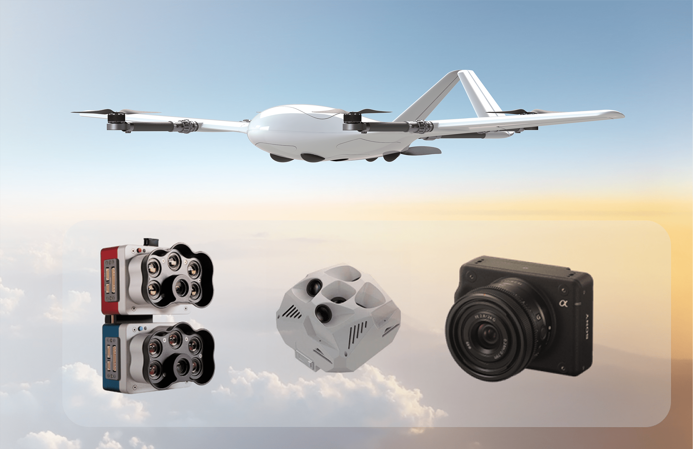
• High-quality Thermal Infrared (TI) and RGB cameras
• Robust AI-powered detection software
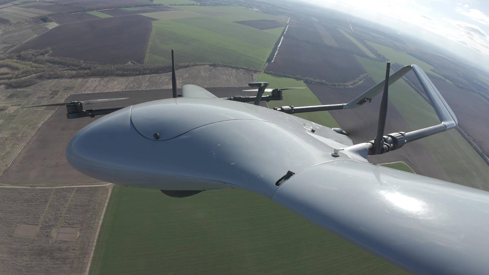
Unlike multirotor drones, fixed-wing UAVs such as GeoHawk are designed for:
• Long-endurance missions (up to ~2.5 hours per sortie)
• Coverage of large geographic areas
• Efficient BVLOS-style operations (hundreds of kilometers range)
• Higher cruise speeds for landscape-scale surveys
For wildlife monitoring, these characteristics are critical. Conservation teams often need to survey vast reserves, wetlands, forests, or agricultural interfaces where endangered species, invasive species, or poaching threats exist.
Hover capability is useful in some missions — but for systematic area coverage and population-scale analytics, fixed-wing efficiency becomes a game changer.
Wildlife Counting & Population Surveys:
• Detect herds in open savannah
• Count nesting seabirds
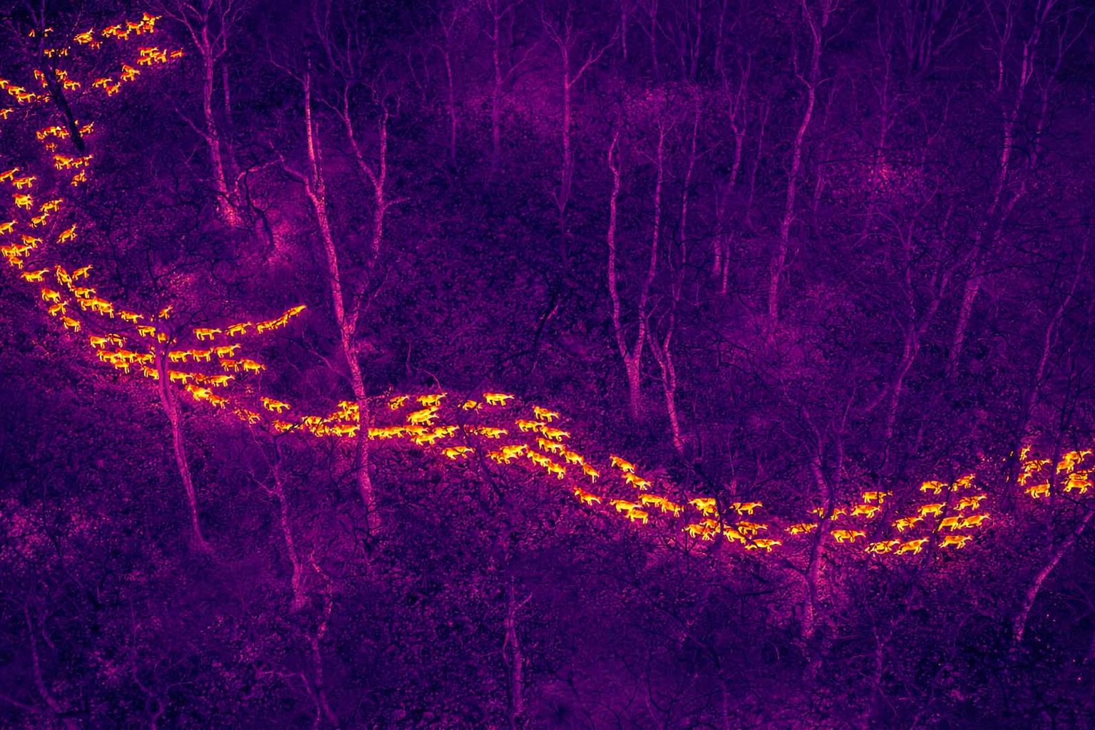
• Monitor deer populations in woodland
• Identify livestock–wildlife interface conflicts
Thermal Surveillance & Anti-Poaching:
• Night-time detection of animals
• Locating poachers
• Identifying injured wildlife
• Detecting hidden animals in vegetation
Habitat & Environmental Monitoring:
• Wetland condition monitoring
• Deforestation tracking
• Land-use change detection
• Floodplain and coastal ecosystem mapping
Large-Scale Conservation Projects:
• Real-time streaming of ML models
• Joint thermal + RGB payload integration
• Field trials for wildlife consultancies
• Pilot programs for conservation NGOs
• Regulatory alignment and SORA pathway development
We build a scalable aerial system capable of supporting wildlife consultants, conservation agencies, and land managers across the globe.
The future of wildlife protection is data-driven, efficient, and collaborative.